 US Army Corps of Engineers Deputy Public Affairs Officer Lisa Parker distributed this flood control update on January 7, 2016 at 2 PM.
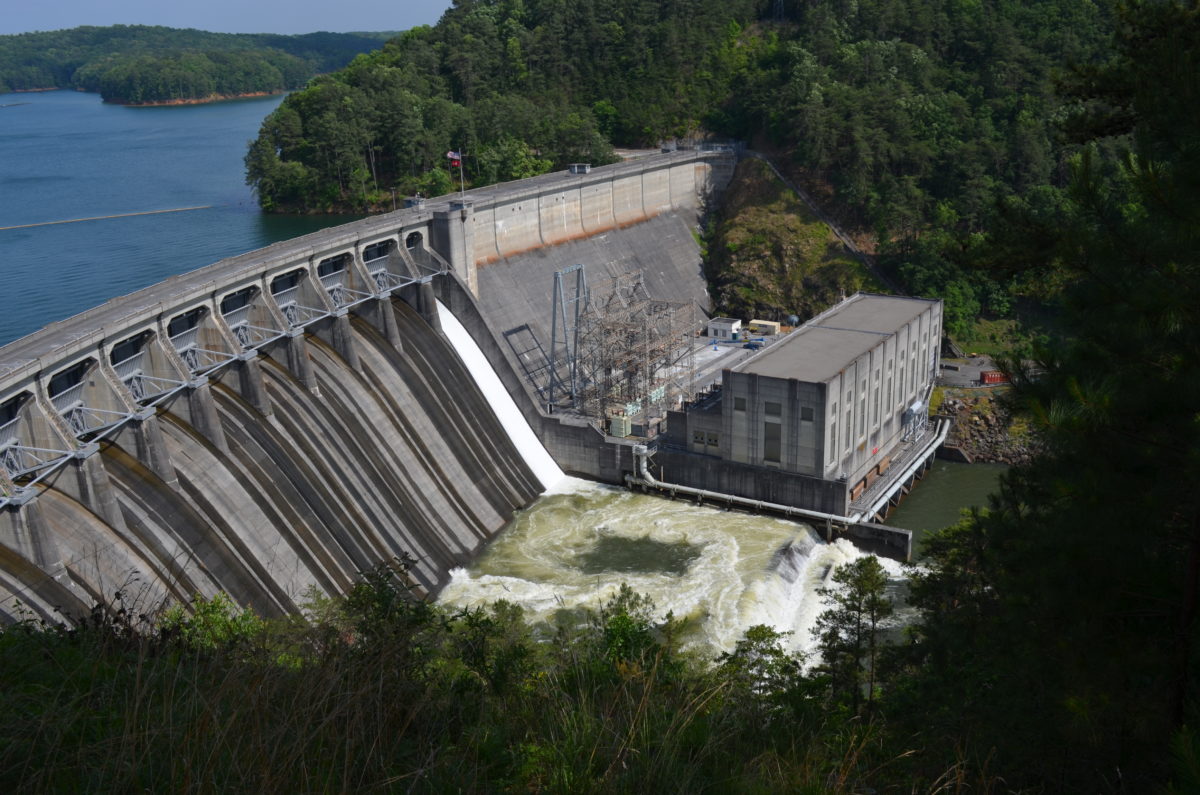
The U.S. Army Corps of Engineers (USACE) Mobile District implemented flood control operations in the Apalachicola-Chattahoochee-Flint (ACF) and Alabama-Coosa-Tallapoosa (ACT) River Basins. Portions of Alabama, Florida and Georgia had received up to 15 inches of rain over 14 days causing the rivers within the basins to rise rapidly.
“USACE curtailed release from Buford Dam on Dec. 22 at Lake Lanier to only minimal releases of approximately 650 cubic-feet-per-second (cfs) through the small house unit,” said Lisa Parker, Deputy Public Affairs Officer. “To reduce flooding downstream, only the small unit was being run at Buford. The small unit generates power for the dam, the project office, maintenance areas and recreational facilities around the lake and assisted in maintaining viable conditions for essential habitat below the dam,” said Parker.
“By limiting releases to just that of the small unit, 60 billion gallons of flood waters were retained at Lanier as the lake level peaked at elevation 1075.5 ft mean sea level (msl). This is the equivalent of filling the Georgia Dome more 100 times,” said Parker. “This allowed downstream river conditions to lower thus preventing much higher levels below Lake Lanier.”
Downstream on the Chattahoochee River, West Point Lake also began storing floodwaters within its flood storage pool as the daily average inflow reached a peak near 65,750 cfs while limiting the downstream release to approximately 35,240 cfs. With the winter drawdown for available flood storage, the project was able to limit the downstream releases below flood levels as the reservoir peaked near 636.4 ft msl.
“On the ACT, USACE curtailed its operations on Dec. 25 at Lake Allatoona to only minimal releases of approximately 300 cfs through the small unit,” said Parker. By limiting the releases out of Allatoona 700 billion gallons of flood water were retained at Allatoona. Carters Lake also stored approximately 500 billion gallons during the event as the lake peaked at 1098.1 ft, a little more than 1-foot below the record high level.
The combined floodwater storage at the two projects was the equivalent of filling the University of Alabama football stadium approximately 4900 times. The flow out of large dams is rarely halted completely due to adverse impacts on river environments. USACE was actively engaged with local, city and state officials, Emergency Managers and others to relay information in a timely and accurate manner.
The ACF and ACT are managed as a system and the flood waters were also being managed through the remaining USACE projects: Walter F. George Dam, Jim Woodruff Dam, R.F. Henry Dam and Millers Ferry Dam. As downstream river conditions improve, USACE is evacuating the stored floodwater in preparation of potential future storm events. USACE continues to monitor the situation and will make necessary changes to water releases to ensure minimal impacts both upstream and downstream.
Flood Control Update: Current elevations (1-7-16) at:
- LAKE LANIER 1074.72
- WEST POINT 627.89
- WALTER F GEORGE 187.94
- ANDREWS TAIL WATER 102.98
- WOODRUFF 76.18
- ALLATOONA 842.98-ft
- CARTERS 1075.88-ft
- RF HENRY TAIL WATER 107.19-ft
- MILLERS FERRY TAIL WATER 69.81-ft
- CLAIBORNE TAIL WATER 51.50-ft